Friday, November 6, 2015

Precision Barometers on Inland Commercial Vessels by Robert Reeder


The necessity of an accurate barometer for an ocean voyage is well understood. However, even in
inland waterways with modern weather resources, our barometer can be an important tool for
weather routing.

My office is a high-speed passenger ferry which crosses the Strait of Juan de Fuca. Seas there are
seldom monstrously high, but in a gale they can become very steep and confused 6' – 8' waves very
quickly, often with ocean swell underneath them. For passenger comfort and safety we endeavor to
not sail when the seas are expected to be this high, and will opt instead to either reroute for more
protected waters, schedule the sailing for an earlier or later weather window, or in the worst-case
transport our passengers on chartered buses.

Canceling, rerouting or rescheduling a sailing is not a trivial consideration. Passengers need to be
contacted and informed, buses may need to be procured, luggage may need to be rerouted, Customs
agents and shore support personnel may need to be rescheuled, additional fueling may be required if
rerouting adds significantly to the duration of the voyage.

Our best onboard and shoreside weather resources are a combination of NOAA GFS and WRF
modeling, and station reports from NOAA National Data Buoy Center and Environment Canada. It
is our experience that the two of these combined typically give a fairly accurate and robust
representation of the weather we can anticipate. However, in this region much of the modeling can
be in error by several hours time, either early or late. In open ocean this would not be a critical
consideration, however on our vessels and our route we are typically only exposed to the worst of
the weather for about an hour. So a modeling discrepancy of three hours can mean either being
caught in weather unexpectedly, or possibly canceling a sailing needlessly.

Correlating the modeling with buoy and shore station obsevations helps. If a weather system is
modeled to be blowing 40 knots in the central Strait at 0600, and the 0600 station report at
Sheringham Point is still only 4 knots, we have a pretty good idea that the system is moving in more
slowly than anticipated. This informs us of the discrepancy between the models and the
observations, but it does not necessarily give us actionable information beyond the fact that the
weather system will likely arrive some time later than anticipated.

By using a well-calibrated on-board barometer we can compare our actual barometric pressure with
that of the WRF model map at the same time. If the mapped pressure band or isobar which
corresponds to our barometer observation is not in our location, we can use the WRF animations to
estimate how many hours earlier or later than predicted the weather system will move through our
position. The simplest way to do this is to toggle the sequential maps backward or forward until the
modeled pressure at our location matches our actual pressure, and then note the UTC time of that
model image to determine the time error.

With this better time estimate of when a weather system will actually move through the eastern
Strait, we can be much better equipped to make decisions of weather routing, or postponing or
cancelling a trip for passenger comfort and safety.

See Specific Examples

Weather Routing Options for Seattle to Victoria by Robert Reeder


Standard Route
Graphic 010)
2 hours 45 minutes 73 nm


This is our normal route between Seattle and Victoria. Through prior agreement with both country's
Vessel Traffic Services, we utilize the Vessel Traffic System lanes from Seattle to Port Townsend.
At the buoy "SA" precautionary area we depart the traffic lanes and transit directly to buoy "R" and
then buoy "VH," then from "VH" to Ogden Point and into the Inner Harbour.

On an ebb current with even moderate westerlies we will often see strong tidal dynamics at
Admiralty Inlet and a "washing machine" effect between Point Wilson and buoy "SA." At this time
there is not a weather buoy at this location.

An important consideration for transiting the eastern entrance of the Strait of uan de Fuca is the
presence of ocean swell. National Weather Service does not ever report this, however a good rule of
thumb is to take the reported westerly or northwesterly swell at the western entrance, and divide
that number by three. Add this to the predicted significant wave height to get a reasonable estimate
of the combined seas.


Strong Southerlies, via Dungeness Spit
(Graphic 020)
2 hours 47 minutes 74 nm


With all of our weather routing, our goal is to obtain as much shelter as possible from windward
landmasses, and also to minimize the amount of time we have the seas and winds on our beam. In
the event of strong southerlies, if we are northbound we will seek permission from VTS to transit
west of and then south of the southbound/eastbound traffic lanes to take advantage of the lees
provided by Foulweather Bluff, Marrowstone island and the Olympic Peninsula. At Dungeness
Spit/New Dungeness lighthouse we turn northwest to cross the Strait toward buoy "VH."
Sometimes with strong southerlies or southeasterlies we will see organized 6 ft seas in Puget Sound
and Admiralty Inlet, while the Strait is flat calm.


Strong Westerlies, via Deception Pass
Graphic 030)
4 hours 8 minutes 110 nm


A direct heading from buoys "SA" to "R" to "VH" is 296° T for almost an hour, which makes for a
very uncomfortable ride with strong westerly winds, seas and swell, especially if there is an ebb
running against them. Once north of the international boundary we get some lessened fetch and an
absence of ocean swell from the lee of Cape Calver, but the remaining seas tend to stack up over
Constance Bank to a significant degree. Also it is common for localized winds just east of Constance
to be much larger than in the rest of the eastern entrance of the Strait.

Under these conditions, it is often advantageous to remain east of Whidbey Island to Deception
Pass, then cross Rosario Strait to Thatcher Pass and take advantage of the relatively protected
waters of the San Juan Islands to Speiden Channel. Then south through Haro Strait to Baynes
Channel.

Note that a strong ebb in these condition will make Deception Pass impassable, in which case
Swinomish Channel may be a better option. Also, it is not advisable to attempt Deception Pass in
hours of darkness, even with radar and GPS chart plotting.


Strong Westerlies, via Swinomish Channel
(Graphic 040)
4 hours 30 minutes 115 nm


Swinomish Channel is only navigable for us when there is at least five feet of tide over MLLW for
the duration of the transit through it. Slowing to a speed commensurate with safe navigation and
also minimizing shoreline damage from our wake definitely turns this into a longer trip. Tugs
towing log booms here and also at Deception Pass often add to the excitement.


Strong Northwesterlies, via Cattle Pass
Graphic 050)
3 hours 34 minutes 97 nm


Simply remaining east of Smith and Minor Islands can sometimes afford some protection; once
inside Cattle Point the rest of the trip is easy. However, some of the roughest seas I have ever seen
in the Strait were between Smith Island and Cattle Point in westerlies, so this option is not usually
my favorite.


Strong Northeasterlies via Davidson Rocks (Graphic 060)
3 hours 32 minutes 93 nm


Sometimes this is a better option than any of the routes which utilize Thatcher Pass, simply because
with northeasterlies Rosario Strait can become very rough very quickly. Another advantage of this
route is that it is quicker than routing throug the San Juans. In some cases if we are uncertain as to
the actual sea state in the Strait, we will head to Davidson first after we exit Deception Pass. Once
at Davidson it will become apparent rather quickly if it isw safe to proceed westward, and if it is not
we can easily duck back behind Lopez Island and head back to Thatcher Pass.

Wednesday, October 14, 2015

Friday, Nov 6, Public Talk on the Use and Role of Accurate Barometers

How an Accurate Barometer can Make your Sailing Safer and More Efficient.

Friday, Nov 6, 6 to 9 PM at CYC, Shilshole Bay Marina, hosted by the Seattle Sailing Club and Corinthian Yacht Club at Shilshole Bay Marina.

No-host bar and restaurant 6 to 7, seminar 7 to 8, questions and panel discussion 8 to 9.

A free public seminar and panel discussion on the role and use of barometers in sailing on both inland and offshore waters. Covers real examples of how an accurate barometer can make your sailing safer and more efficient. Examples of what can happen when you do not heed the advice they provide are also given. 


Presented by David Burch, Starpath School of Navigation and author of The Barometer Handbook, and Matt Thompson, NWS Port Meteorological Officer, who coordinates barometer use and other aspects of weather reports from Voluntary Observing Ships. Also taking part in the Panel Discussion is David Wilkinson, meteorologist and marine weather instructor at the Northwest Maritime Center and Robert Reeder, Chief Mate on the Victoria Clipper, who relies daily on accurate pressure to confirm the timing of UW hi-res forecasts.

For more information, contact Scott Galbraith at Seattle Sailing Club. Join us for dinner and conversation on the important role of barometers in navigation.


For a general background on use of barometers see Modern Barometry and its Important Role in Marine Navigation, but we will be more specific in this discussion with real examples of how the barometer ca affect your decision making.

A more extensive list of references and resources for the talk is at
www.starpath.com/cyc
 

Saturday, October 10, 2015

Personal Beaufort Scale

A question came up recently about the Beaufort Scale for relating wind speed and sea state. I immediately referred to what I have called a personal Beaufort scale and directed my friend to our book Modern Marine Weather.  It turns out, however, to my embarrassment, this discussion is not in that book, where it should be.  Instead, we have this in the Inland and Coastal Navigation book, so i am adding it here—essentially a copy of parts of Section 5.3 The Effect of Wind on Boat Speed. [We will add this to the next printing of the weather book.]
 

To make guidelines on expected effects of wind requires guidelines on judging wind speed, assuming wind speed instrumentation is not available for measuring it. Actual wave heights do not help with this, even if they could be estimated accurately, which is unlikely. [Wave heights in local waters are discussed at the end.]

It is better to use the general appearance of the water as described by the Beaufort Wind Force Scale. Wind speed can be read from the water this way to within a few knots, after practicing with an anemometer to check the guesses. 

[The problem with trying to use the wave heights alone as sometimes listed with the Beaufort scale (wave heights were not in the original scale) is these heights are determined by many factors besides the wind speed. On the other hand, we need to know average heights and steepness because the value of this knowledge is knowing how to decide if the sea state is indeed consistent with the wind speed, assuming both are in equilibrium... ie you are viewing "fully developed seas."  If they are not consistent, ie too big or too steep, then you know you are in current flowing into the wind, or likewise too low heights means either current with the wind, or the wind has not been blowing long enough in the same direction to build the seas you are eventually going to get.]

A wind speed of approximately 10 knots is the easiest to read from the water, which is fortunate because this is the wind speed at which low-powered craft must start considering the wind’s effect on progress. With no current flowing, the appearance of the first few isolated whitecaps means the wind speed is approximately 10 knots. At this wind speed, you have to search the surface to detect these few whitecaps that look like scattered bits of popcorn on the water.  
Current flowing into the wind steepens the waves, so they break making whitecaps more easily. With a current of 1 or 2 knots flowing into the wind, the popcorn will appear sooner, at approximately 8 knots of wind. Current flowing with the wind stretches out the waves, so the wind speed must build to 12 knots or so before any specks of white are seen.  

At an honest, sustained wind of 20 knots, the popcorn is the first thing that catches the eye. Individual whitecaps are bigger, and there are many more of them. During the first few hours of wind, before the seas build, the water looks like a speckled quilt of whitecaps, but there is little if any spray. Nearby wave surfaces, however, will show prominent streaks of cat’s paws (ripples that look like fish scales), which show very clearly the instantaneous wind direction. 

With some experience of 20 kts seas, ie knowing the density of white caps needed to be the dominant thing you see, then the more scattered density of 15 kts becomes easier to discern.  So we have 10 kts, have to look hard; 20 kts it knocks you out; and 15 kts is in the middle.  Note too we are talking about inland waters here for the most part... that is we are rarely looking at fully developed seas and these signs discussed here will appear relatively quickly with the new wind speed.  

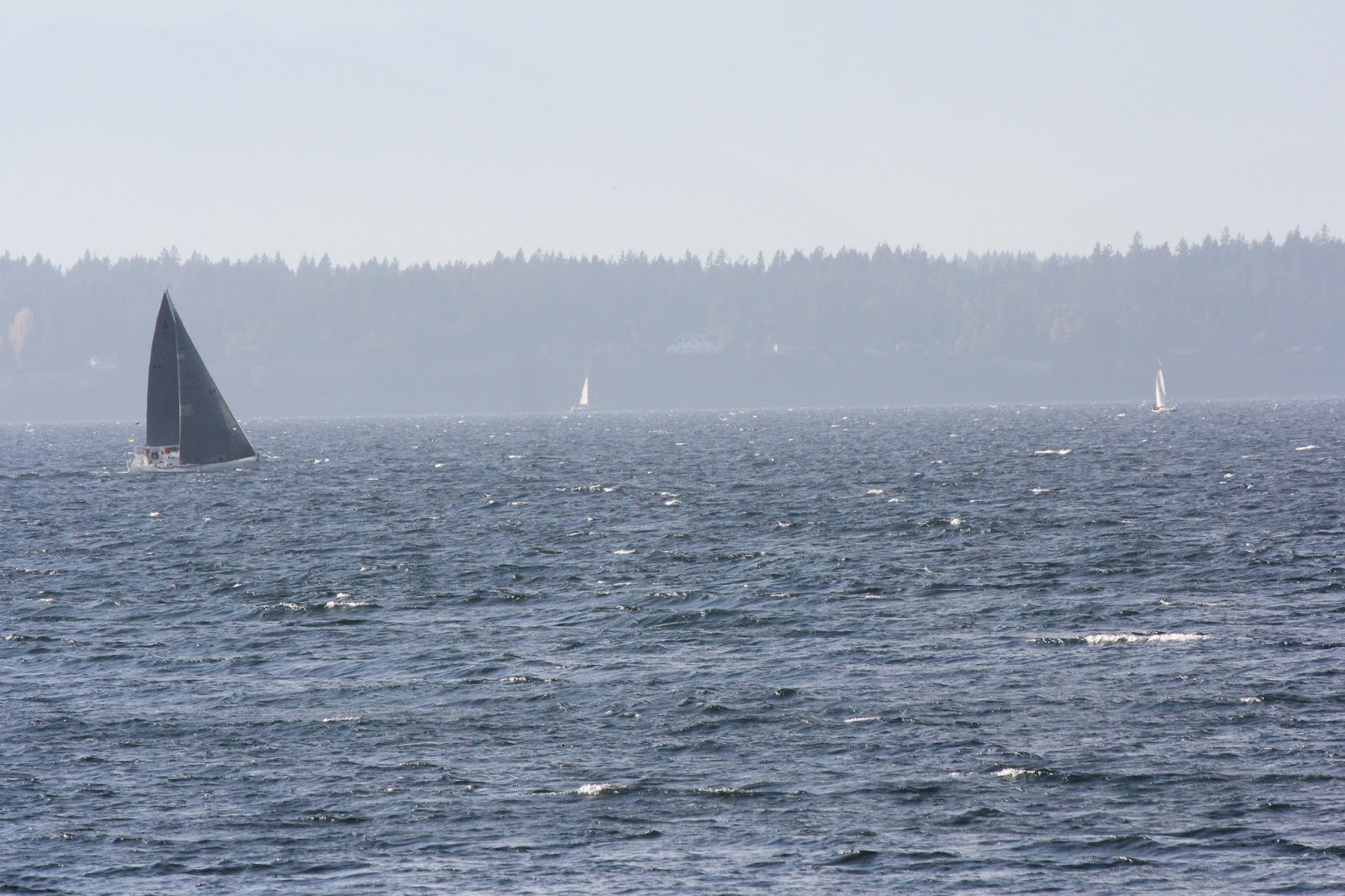
And example of 15 kts, ie we do not have to look for the whitecaps, but we are also not overwhelmed by the whitecaps.

The picture above was at about 1500 PDT, during the flat period here of sustained  15-16 kts. This wind meter is on a low flat point of land about 0.4 nmi behind the gray sails and known to be a good measure of wind speed in the area of the picture.


Conspicuous spray blown off the crests of whitecaps and streaks of foam are the signs of 30 knots of wind. This, however, is very strong wind, indeed. There are not many places close to land where such winds last more than an hour, and even in these places, if this wind persists for over an hour it must be associated with a large weather system that would have been well forecasted. 

In a solid 25 kts of wind, you will see patches of spray indicating some 30-kt gusts, which in a sense helps ID the base strength of about 25 kts.That is, a sustained wind of 20 kts will not have many if any gusts to 30 kts, and hence no patches of spray.

A sustained wind of 30 knots will likely contain gusts to high 30s.  To appreciate the forces involved, imagine holding a two-square foot board (17 inches on a side) out of a car window when traveling at 40 miles per hour (35 knots). 

At 40 kts you are generally wearing goggles due to large amounts of spray flying along with the wind.  I have little direct experience with wind this strong, but the one time I had more time than I wanted, the thing that impressed me the most was the cat's paws on the wave surfaces. These were no longer painted scallops showing the direction of the wind, but they were deeply gauged, like the wave surface had a thick tile surface. 


Just for reference, at the low end of the spectrum, 4 knots of wind is the threshold for feeling the wind on your face or neck. This is not a particularly significant observation for powerboaters, but it is a fairly accurate measure that might be of interest to sailors. 

Weaker winds (1 to 3 kts) can be seen to move smoke (ie incense stick) but are not felt... unless, of course, you are a very sensitive person. If you can definitely feel the wind on your face, it is more like 4 knots or more.

Note on local wave heights:

In Puget Sound and connecting waters the fetch of the wind (which affects the wave heights) varies significantly with location and wind direction. In the Appendix to Marine Weather of Western Washington there is an extensive set of tables that compute wave height as a function of duration and wind speed at various locations around Puget Sound, Admiralty Inlet, and Strait of Juan de Fuca. 

.... just found by accident where else we had these notes, in our public online Glossary, but we will leave them here anyway. This link has historical notes on the scale as well.  In principle our weather students would have found this discussion there, which is likely why it has not come up in other discussions.